Wednesday, December 29, 2010

System Earth via Geodetic-Geophysical Space Techniques 2010


A thick 587 pages book "System Earth via Geodetic-Geophysical Space Techniques" was published by Springer in 2010. The book was edited by Frank Flechtner (GFZ), Thomas Gruber (TU Munchen), Andreas Guntner (GFZ), Miora Mandea (IPGP France), Markus Rothacher (ETH Zurich), Tilo Schone (GFZ) and Jens Wickert (GFZ). The book is the continuation of the book series on Champ, Grace and Goce mission results. The first book in this series was "Observation of the Earth System Space" published in 2006 and was edited by Flury, Rummel, Reigber, Rothacher, Boedecker  and Schreiber.


Flechtner et al (Springer 2010)

Contents:

Part 1 - Champ and Grace; Part II - Grace; Part III - Goce; Part IV - Seavar (Sea Level Variation); Part V - Tivagam (Continental Water Storage Variations from Grace Time-Variable Gravity Data); Part VI - NRT-RO (Near Real Time Provision and Usage of Global Atmospheric Data from Champ and Grace); Part VII _ Magfield (The Earth's magnetic field at the Champ satellite epoch); Part VIII - GGOS-D
- - - - -

Monday, December 20, 2010

IAG 135 - Gravity, Geoid & Earth Observation - Crete (2008)


IAG 135 "Gravity, Geoid & Earth Observation" is the proceedings of the IAG International Symposium Commission 2 - Gravity Field. The symposium was held in Chania, Crete, Greece in June 2008. The proceedings was edited by Stelios P Mertikas of TU Crete.

Besides covering the traditional research areas (i.e., gravity, geoid and geodynamics), special attention was paid to the use of geodetic methods for: Earth observation, environmental monitoring, Global Geodetic Observing System (GGOS), Earth Gravity Models (e.g., EGM08), geodynamics studies, dedicated gravity satellite missions (i.e., GOCE), airborne gravity surveys, Geodesy and geodynamics in polar regions, and the integration of geodetic and geophysical information.


IAG 135 (Published in 2010)
- - - - -

Saturday, December 18, 2010

Surveillance & Monitoring Symposium Melbourne (1989)


Another institution whom active in handling symposium on deformation besides the one organized by FIG is the Department of Surveying, U of Melbourne. They have organized an event "Surveillance & Monitoring Symposium - SAMS '89. The symposium was held at Melbourne University in November 1989.


Proceedings SAMS'89
- - - - -

Wednesday, December 15, 2010

Groten - Airborne Gravimetric Studies 1989


An early paper on airborne and satellite borne gravimetric studies was written by Erwin Groten way back in 1989. This is among the pioneer papers on airborne gravimery. Groten is with Institute of Physical Geodesy, TU Darmstadt. The paper among others discussed the principles of airborne and satellite borne recovery of the gravity field where the ideas of global gravity field determination based on spherical harmonics expansion.

Source - elsevier


Edwin Groten (b.1935)
Dipl-Ing TUM 1959; PhD TUM 1963

Groten works in early days with R Sigl and retired in 2003. Groten cv can be read here - iugg.
- - - - -

Tuesday, December 14, 2010

Numerical solution of Molodensky problem – Sideris & Schwarz (1988)


During period 1987- 88 saw many research developments on gravity field reported by Calgary group. One of them is a paper “Advances in the numerical solution of the linear Molodensky problem” by MG Sideris and KP Schwarz published in Bulletin Geodesique 62:5-69 (now known as J of G).


Source – BG1988.


- - - - -

Monday, December 13, 2010

OSU GS Geodynamic Program 1988


OSU Geodetic Survey is very active in geodynamics program. In 1988 a report "Basic research for geodynamics program (at OSU)" was prepared for NASA by GS Dept. Report by Ivan I Mueller covers activity from July 1, 1987 through June 30, 1988.


Ivan I Mueller (retired in 1992)
source - iugg

Among the activities covered were;

1. Earth Rotation Parameter Determination from Different Space Geodetic Systems
2. Utilization of Range-Difference Observations in Geodesy
3. An Algorithm for Crustal Deformation Analysis
4. Orbit Determination for the Global Positioning System of Satellites
5. Reference Frames for Geodynamics

Among the publications as research outcome were;

1. Further Considerations on Combining Earth Rotation Observations from Different Space Geodetic Systems, Bulletin Geodesique, 1988.
2. Baseline Estimation with Semidynamic and Geometric Satellite Methods, Bulletin Geodesique, 1988 or 1989.
3. Orbit Determination for the Global Positioning System Satellites, First Quarterly Status Report, January, 1988
4. Reference Coordinate Systems: An Update, Proc. International Summer School of Theoretical Geodesy on Theory of Satellite Geodesy and Gravity Field Determination, May 23-June 3,1988, Assisi, Italy

Read report by Ivan Mueller submitted to NASA (source - here)

- - - - -

Saturday, December 11, 2010

UNB's paper at FIG 1988 Symposium


There were a number of papers by UNB SE group presented at 1988 Symposium. Among them were;

"Integration of the GPS with geodetic levelling surveys in ground subsidence studies"

"Integration of geotechnical and geodetic observations in the geometrical analysis of deformations at the Mactaquac generating station"


Mactaquac Dam
(the case studies of deformation monitoring survey were done by UNB SE team)
- - - - -

Thursday, December 9, 2010

Deformation Symposium - Fredericton (1988)


Dept of SE UNB hosted the 5th FIG Symposium on Deformation Measurement held in Fredericton on June 1988. The organizing committee of the symposium was chaired by Prof Adam Chrzanowski.


The proceedings

I have made a wrong move not attending this symposium even though were there. I took leave instead and went home for summer break.
- - - - -

Monday, November 1, 2010

Pelajar PSM 2010/11


Pada sesi 2010/11 ada empat pelajar 4Sgu yang berminat untuk membuat PSM dengan tajuk mereka kesemuanya melibatkan least squares adjustment. Mereka ialah;
  1. Muhammad Izzudin bin Abdul Jalil - " Software development for EDM calibration computation with implementation of Variance Component Estimation method"
  2. Md Yusop bin Usak "The adjustment of precise levelling network with emphasis on the optimization of error modelling"
  3. Erlya Herlin bt Ngadimin "The adjustment of precise levelling network: Incorporating the post-analysis using Almost Unbiased Estimation technique".
  4. Abza bt Khalid "The modelling of correctivesurface for GPS height conversion in Klang Valley".
Abza mengerjakan projek tesisnya dalam satu semester saja (ie., semester 2) setelah menukar kepada tajuk baru kerana tak mahu meneruskan tajuk asalyang baerkaitan dengan smart watch heighting accuracy.
 - - - - -

Wednesday, October 20, 2010

GOP Final Year SGU (2010)


I was involved in organizing and handling the Global Outreach Program (GOP) for geomatic students in 2010.The GOP was designated to Hong Kong and the trip was joined by about twenty students of final year geomatic undergraduate (4Sgu). This was the second in GOP series. The first GOP was to ITB Bandung organized by Mr Shaharudin Mohd Said.
The GOP to HK departed from AirAsia Terminal Sepang afternoon flight at 4pm. We arrived HK after four hours at about 8pm.


Just landed at HK International Airport


Short briefing given on arrangement from airport to Kowloon


Dinner time at McD Hung Hom Train Station, Kowloon
- - - - -

Saturday, October 9, 2010

A Brief History of Geodesy at OSU

Dept of Geodetic Science OSU sangat terkenal sebagai institusi geodesi pada satu masa lalu terutama pada era penciptaan teknologi satellite geodetik. Berikut adalah catatan sejarah penubuhan dan perkembangan GS di OSU.

Source - link OSU.

A Brief History of Geodesy at OSU

1947: The Mapping and Charting Research Laboratory first offers degrees.

1950: The Institute of Geodesy, Photogrammetry, and Cartography is established (G. Harding, Director; W.A. Heiskanen, Scientific Director).

1953: First M.S. degree is awarded (to W.M. Kaula).

1955: First Ph.D. degree is awarded (to C.E. Ewing).

1961: The Institute becomes the Department of Geodetic Science in the College of Mathematical and Physical Sciences.

1964: Prof. Urho Uotila begins 20-year chairmanship of the Department.

1975: B.S. in Surveying is added.

1981: The department name changes to Geodetic Science and Surveying.

1984: Prof. Ivan Mueller becomes chair of the Department.

1986: 35 years of Geodetic Science at OSU. The Center for Mapping is established, largely with efforts by the Department; Prof. John Bossler becomes its director.

1992: Prof. Clyde Goad becomes chair of the Department.

1995: The Department is transferred to the College of Engineering under a university-wide re-structuring exercise.

1996: The Department merges with Civil Engineering, which becomes Department of Civil and Environmental Engineering and Geodetic Science.

1996: The Geodetic Science and Surveying Program continues within the new department, but independently of Civil Engineering programs.

1998: B.S. in Surveying is changed to B.S. in Geomatics Engineering.

2002: The Geodetic Science Program celebrates 50 years at OSU with the W.A. Heiskanen Symposium in Geodesy.

2005: The majority of Geodetic Science faculty moves to the Department of Geological Sciences (College of Mathematical and Physical Sciences).

2006: The Department of Geological Sciences becomes the School of Earth Sciences with divisions, one being the Division of Geodesy and Geospatial Science.

2009: The Geodetic Science Graduate Program moves entirely to the School of Earth Sciences. The Division name changes to Division of Geodetic Science. Geodetic Science in engineering becomes a track, Geoinformation and Geodetic Engineering, in the Civil Engineering Graduate Program.


Pelajar PSM pada 2016

- - - - -


Wednesday, September 29, 2010

IAG 112 - Geodesy & Physics of the Earth


IAG 112 Symposia on Geodesy and Physics of the Earth is the proceeding of the 7th International Symposium "Geodesy and Physics of the Earth". The symposium was held in Potsdam in October 1992 hosted by newly established GFZ. The proceedings was convened and edited by Horst Montag and Christoph Reigber both of GFZ.


IAG 112


Ch Reigber (PhD 1969 TUM)
- - - - -

Tuesday, September 28, 2010

IAG 111 - Recent Geodetic and Gravimetric Research in Latin America


IAG 111 is themed "Recent Geodetic and Gravimetric Research in Latin America". This book is a proceedings of the lAG Symposium "Second Joint Symposium of the International Association of Geodesy and the Pan-American Institute of Geography and History". The symposium was held during IUGG General Assembly in Vienna in August 1991.  The proceedings was convened and edited by Wolfgang Torge. Altogether 20 scientific contributions were given at the Symposium under the following sessions;
  1. Geodetic and Gravimetric Control in Latin America
  2. Regional Gravity and Geoid Determination
  3. Geodynamic Research Projects


IAG 111 (Springer 1993)


Wolfgang Torge (b.1931;  PhD 1966 Hannover)
- - - - -

Sunday, September 26, 2010

IAG 110 - From Mars to Greenland


IAG Symposia 110 themed sounds very catchy "From Mars to Greenland: Charting gravity with space and airborne instruments". This book was published as proceedings of the Symposium on the Determination of the Gravity Field by Space and Airborne Methods held in Vienna in August 1991. The proceedings was edited by Oscar Colombo of Goddard Space Flight Center, Maryland, USA.


IAG 110 (Springer 1992)
- - - - -

Friday, September 24, 2010

TA Clarke PhD 1991


Another PhD work on surveying technology was submitted and this one is to City Univ in 1991 (besides work by TJM Kennie also in 1991). TA Clarke work on "Application of optical techniques to surveying" submitted to Dept of Electrical, Electronic and Information Engineering, City University.

The thesis addressed the problem of acquiring spatial data concerning points on the surface of structures such as underground tunnels and sewers. These data can usually provide knowledge of deformation, shape, area, volume, and position of structures.

The work was done at time where TLS is still not available yet.

Source for download the thesis - link.


City Uni, London
- - - - -

Wednesday, September 22, 2010

TJM Kennie Phd 1991


Nama TJM Kennie sering diingati dan disebut bila memberi kuliah tentang surveying technology. Beliau menulis beberapa buku dengan tajuk berkaitan surveying technology. Antaranya ialah bersama G Petrie. TJM Kennie memperolehi PhD pada 1991 di Imperial College London. Tesis belia berjudul "Developments in surveying technology and their application to engineering geology". Tesis dikemukakan kepada Dept of Geology, Imperial College of Science, Technology and Medicine, University of London. Tesis setebal 583 m/surat boleh diakses melalui pencarian google.


Geology Walks, London Uni

- - - - -

Monday, September 20, 2010

IAG Symposia Proceedings (1991 - 1994)


IAG has made effort with accordance of the new editing policy that the Proceedings of IAG Symposia are now published by Springer Verlag. This new procedure was already used for the publication of several Symposia (101 to 108). The following proceedings has been published since Vienna meeting;

109 Permanent Satellite Tracking Networks for Geodesy and Geodynamics, Vienna, 1991
110 From Mars to Greenland: charting gravity with Space and Airborne Instruments, Vienna, 1991
111 Recent Geodetic and Gravimetric Research in Latin America, Vienna, 1991
112 Geodesy and Physics of the Earth, Potsdam, 1992
113 Gravity and Geoid, Graz, 1994
114 Geodetic Theory Today, L’Acquila, Italy 1994


Geodasie, Uni of Vienna [fb - link]
- - - - -

Saturday, September 18, 2010

IAG 109 - Permanent Satellite Tracking Networks (1993)


IAG 109 is the Symposium on Permanent Satellite Tracking Networks for Geodesy and Geodynamics. These proceedings include many of the papers presented at the Symposium on Permanent Satellite Tracking Network for Geodesy and Geophysics held in Vienna Austria, August 1991, as part of the IUGG General Assembly and IAG Meeting. The symposium was convened to promote the establishment of an International GPS Service under the auspices of the lAG. Gerald Mader of Geosciences Laboratory Maryland, USA convened and edited the proceedings of the symposium. The symposia also led to the establishment of IGS.


IAG 109 (published in 1993)

The proceeding starts with a long report by Ivan I Muller "Planning an International Service Using the GPS for Geodynamic application"
- - - - -

Thursday, September 16, 2010

IAG 108 - Applications of Geodesy to Engineering


IAG 108 is a proceedings of the symposia of Applications of Geodesy to Engineering. The proceedings was convened and edited by Klaus Linkwitz, Viktor Eisele and Hans-Joachim Monicke. Linkwitz and Monicke are both from Stuttgart University while Eisele is with Landesvermessungsamt Baden-Wiirttemberg, Stuttgart.  The lAG Symposium No. 108 was held at the University of Stuttgart, Germany, from 13th
to 17th May 1991.

Georgi Milev as Chairman of Commission 6 FIG presented a paper "State of the Art and Development of Engineering Geodesy and Activities of the FIG Commission 6" during the symposium.


IAG 108
- - - - -

Tuesday, September 14, 2010

IAG 107 - Kinematic System in Geodesy


The IAG Symposium 107 "Kinematic System in Geodesy, Surveying & Remote Sensing" was successfully held in Banff Alberta in September 1990. The proceedings of this symposium was convened and edited by Klaus-Peter Schwarz and Gerard Lachapelle of Calgary University. The symposium was held to gather report among others on the development progress of kinematic approach of GPS surveying (a topic of interest to many at that time period).


IAG 107
- - - - -

Saturday, September 11, 2010

IAG 106 - Determination of the Geoid (1991)


IAG Symposium 106 "Determination of the Geoid: Present and Future" was held in Milan, Italy in June 1990. The proceedings of the symposia was convened and edited by Richard Rapp of OSU and Fernando Sanso of Politecnico Milano. The paper presentations were organized into five main themes as follows;
  1. Global Geopotential Models - present and future (chaired by Richard Rapp)
  2. The role of topography in geoid computations (chaired by Rene Forsberg)
  3. The geoid and GPS (Wolfgang Torge & Hans George Wenzel)
  4. Theoretical improvements in the determination of the geoid (chaired by Sanso)
  5. Software and data improvement for geoid computations (chaired by Tscherning)


IAG 106
- - - -

Wednesday, September 8, 2010

FIG XIX Congress Helsinki (1990)


The FIG 19th Congress was held in Helsinki Finland in 1990. There is no printed volume of proceedings available at UTM Library. One of prominent papers on deformation analysis by Adam Chrznowski was presented there. The paper entitled "Deformation monitoring, analysis and prediction - status report". The abstract can be downloaded at the following link.

Adam90


TKK Library, Helsinki University of Technology
- - - - -

Sunday, September 5, 2010

Figure of the Earth (Moritz 1990)


Helmut Moritz is very associated with topics on Physical Geodesy. He has authored and co-authored many books on physical geodesy and topic related to it. One of such books is ” The Figure of the Earth – Geodesy and the Earth’s Interior” published in 1990 by Wichmann Verlag, Karlsruhe. This book is very rare to find.

Helmut Moritz, 1990

(Source – amazon)

(Source – U of Toronto library)


- - - - -

Saturday, September 4, 2010

Geoid for British Isles - (Stewart PhD 1990)


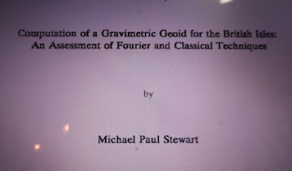
Michael Paul Stewart graduated with a PhD from U of Edinburgh. His thesis entitled "Computation of a gravimetric geoid for the British Isles: An assessment of Fourier and classical techniques". The research was supervised by Dr Roger Hipkins.


Michael Peter Stewart (1990)

Chp1 Introduction; Chp 2 Theoretical background - introduction to Fourier transforms; the Earth gravity field; Chp 3 Data: sources and compilation; Chp 4 Spherical harmonics; Chp 5 Practical aspects of computation using Fourier transform; Chp 6 Geoid computation using Fourier transforms; Chp 7 Geoid computation using Stokes' formula; Chp 8 Accuracy og gravimetric geoids solution.

Dell D July 18 TC
- - - - -

Friday, September 3, 2010

Variations in Earth Rotation (1990)


Those who are interested in Earth rotation (as a research topic in geodesy) should access a monograph published by AGU & IUGG "Variations in Earth Rotation". In more specific it is published as Geophysical Monograph 59, IUGG Vol 9, published in 1990. The publication was edited by Dennis D McCarthy and William E Carter, and it was actually a compilation of papers presented at IUGG/IAG meeting held in Vancouver, August 1987.

Source - here.


IUGG Vol 9

Among the contents are;

International Cooperation in the Study of the Rotation of the Earth G. A. Wilkins (pg. 1)
Variational Calculation of Wobble Modes of the Earth D. E. Staylie (pg. 5)

Source: Dell D July18 TC
- - - - -

Friday, August 27, 2010

IAG 105 - Earth Rotation and Coordinate Reference Frames


The theme of IAG Symposia 105 is "Earth Rotation and Coordinate Reference Frames". The convenor and editor of the symposia were Claude Boucher and George A Wilkins. Boucher is with Institut Geographique National, France while Wilkins is from United Kingdom. One of the significant developments leading to this symposia was the establishment of IERS on January 1, 1988.


IAG 105

Among the interesting papers presented were;

"SLR and orbit determination at Nottingham University' by Ashkenazi, Hill and Moore
"Prediction of polar motion by LS collocation" by Galas and Rudolf Sigl
- - - - -

Thursday, August 26, 2010

IAG 104 - Sea Surface Topography and the Geoid


IAG 104 is a proceedings of the symposia of Sea Surface Topography and the Geoid. The proceedings was convened and edited by Huns Sunkel and Trevor Baker. Sunkel is Professor at the Institute of Mathematical Geodesy, Graz University of Technology while Baker is attached with Bidston Observatory in the United Kingdom. There were four main sessions involved - the Geoid, Sea Surface Topography, the vertical datum and a mixed of topics session.


IAG 104


Among the papers presented were;

"Kernel modification in generalized Stokes's technique for geoid determination" by Vanicek and LE Sjoberg (pg. 31-46)
"A gravimetric geoid in Taiwan area" by Ruey-Gang Chang et. al
"The determination of mean sea level using GPS" by Ashkenazi, Dodson, Baker and others.

- - - - -

Tuesday, August 24, 2010

IAG 103 - Gravity, Gradiometry and Gravimetry


IAG Symposia 103 - Gravity, Gradiometry and Gravimetry. This volume was edited by Reiner Rummel & Roger Hipkin. At that time Rummel was attached with TU Delft while Hipkin at Dept of Geophysics U of Edinburgh. The latter was also one of local organizing team members of this IAG Meeting.


IAG 103 (1990)
- - - - -

Sunday, August 22, 2010

IAG 102 - GPS: An Overview


IAG Symposia 102 themed GPS: An Overview and the proceedings was edited by Yehuda Bock and Norman Leppard. Bock  is attached at Scripps Inst of Oceanography, La Jolla CA while Leppard is from United Kingdom. The significant of this symposia was in the sense that the GPS constellation is only beginning to approach its full operational phase with the launching of the first five Block II satellites by the end of 1989.

Among the paper in this proceedings is "Some first experiences with the WM102 GPS Receiver" by Jadwiga Piechocinska and LE Sjoberg of Sweden.


IAG 102 (1990)
- - - - -

Friday, August 20, 2010

IAG 101 - Global & Regional Geodynamics


The IAG Symposia 101 themed as Global & Regional Geodynamics. The proceedings is edited by Pavel Vyskocil of International Center on Recent Crustal Movement, Prague; Christoph Reigber of German Geodetic Research Institute, Munchen and PA Cross of University of Newcastle upon Tyne.


IAG 101

The proceedings content was focused on the following topics;
  • Global Plate Motions
  • Instrumentation and Modelling
  • Regional Dynamics
  • Modelling of Deformation
  • Deformation Studies by GPS
  • Horizontal Crustal Movements
  • Vertical Crustal Movements
  • Gravimetry and Crustal Deformation
Among the papers presented were the development of several recent global plate models using Lageos and other geodetic observations;
Sjoberg presented "A Refined Adjustment Model for the Secular Change of Gravity on the Fennoscandian 63 degree Latitude Gravity Line"
Barbarella, Maurizio, Fabio Radicioni, Kalman Filtering in Levelling: An Application.
- - - - -

Wednesday, August 18, 2010

IAG Edinburgh 1989 & Bjerhammar


IAG Symposium in Edinburgh was hosted jointly by the Royal Society, the Royal Society of Edinburgh and the University of Edinburgh. Prof Roger Hipkin (of Geophysics Dept, Edinburgh University) has involved in organizing this event. The symposium also saw the presentation of the Levallois Medal to Professor Arne Bjerhammar. IAG President at this particular symposium was Professor Ivan Mueller of Ohio State University.


Arne Bjerhammar (1917-2011, aged 93)
- - - - -

Monday, August 16, 2010

IAG Symposia - Ediburgh 1989


In August 1989 IAG celebrated its 125th anniversary. To commemorate the event a series of IAG Symposia was held in Edinburgh, Scotland hosted by University of Edinburgh. This General Meeting later was re-named as Scientific Assembly. The first assembly was held in Tokyo (1982) and 1989 Edinburgh Meeting was the second. There were five symposiums held at Edinburgh meeting with theme as follows;

Symp 101 Global and Regional Geodynamics
Symp 102 GPS and other Radio Tracking Systems
Symp 103 Gravity, Gradiometry and Gravimetry
Symp 104 Sea Surface Topography
Symp 105 Earth Rotation

The meeting and symposia was held at Appleton Tower U of Edinburgh. What is so special about Appleton Tower? The Tower was named in posthumous honour of physicist Sir Edward Appleton (1892-1965). He was the Principal who oversaw the development from vision into concrete reality of the 1960s Edinburgh University buildings around George Square. Appleton won the Nobel Prize in Physics in 1947 for his seminal work proving the existence of the ionosphere during experiments carried out in 1924.


Appleton Tower (circa 2011)

- - - - -


Friday, August 6, 2010

Majlis Penutup Hydro 1


Selesai kursus Hydro I sesi penutup diadakan diikuti dengan penyampaian sijil. Turut hadir ialah wakil FIG dan wakil Cida (sebagai penganjur bersama).

Sesi penutup dihadiri bersama oleh TNC (HEP)


- - - - -

Wednesday, August 4, 2010

Geodesy - Hydro 1 (1998)


Back in 1998 I was given the task teaching geodesy to the participants of Hydro Cat B conducted at UTM. The lecture and lab for the subject took thirty four contact hours. The content of the subject among others were geodetic datum, satellite geodesy, adjustment computation and map projection.


Example of the test answer scripts
- - - - -

Tuesday, August 3, 2010

Kursus Hydro 1 (1998)


Ketika operasi mengemas dokumen lama yang tersimpan terjumpa pulak info tugas semasa mengajar kursus Hydro 1  - Cat B pada 1998. Subjek yang terlibat ialah Geodesi dengan jumlah pertemuan selama 34 jam. Lapan calun mendaftar dan mengikuti kursus yang dianjur oleh Center for Hydrographic Studies. Penyelaras kursus pada ketika itu ialah Encik UD. Subjek Geodesi kursus Cat B ini selesai pada Oktober 1998.


Senarai peserta Kursus Hydro 1

- - - - -

Wednesday, June 2, 2010

Sejarah Syarikat Peralatan Ukur Kern


Selain syarikat Wild ada sebuah lagi syarikat yang amat sinonim sebagai pengeluar peralatan ukur iaitu Kern. Kedua-dua syarikat pengeluar ini berpengkalan di Switzerland. 

Berikut adalah beberapa catatan ringkas tentang sejarah syarikat Kern. Kesemua info dipetik dari sumber berikut (link - kern milestones):


1819: Founding of Mechanische Werkstattle "Jakob Kern" Aarau, Switzerland. The first items produced were drawing instruments. 

1835: Later, he became well known for his geodetic and astronomical instruments including the theodolite which was purchased in 1835 for the well known General Dufour, who made the first triangulation survey in  Switzerland.


Theodolite produced by Kern in 1835 

1857: The two sons of Jacob join the firm - Adolf Kern-Saxer and Emil Kern-Rychner.

1857: new location - Zieigel, Aarau

1863: Jacob Kern retired from business

1885: Adolf Kern retired from the business and his son Heinrich Kern (1857-1934) assumed management responsibility for the firm.

1887: Emil Kern retired from business

1914: Foundation of a company Kern & Co AG.

1933: Heinrich Kern retired from business. His son Walter Kern (*1888) was managing the firm.

1933: Heinrich Wild signed an agreement for manufacturing a new theodolite with Kern Aarau.


13 May 1988: Merged with the Wild Leitz group.

1991:    After over 170 years, the company Kern & Co. Ltd. Aarau closes.

Baca juga kern aarau (link).


Logo Syarikat Kern 

- - - - - 

Wednesday, May 19, 2010

Sejarah Penubuhan Syarikat Wild


Syarikat Wild yang berpengkalan di Heerbrugg amat terkenal dengan produk peralatan ukur. Sejarah penubuhan dan perkembangan Syarikat Wild sudah pun mejangkau ratusan tahun usianya. Ia mula ditibhukan pada 1921 dengan nama Wild Heerbrugg. Tokoh yang berjasa disebalik penubuhan Wild Heerbrugg adalah Jacob Kern (d.1867). Berikut sedikit ringkasan tentang perkembangan Wild. Semua info dipetik dari sumber Leica - link.

Baca juga catatan history mereka - blog. Sedikit tentang Kern - link.

1819

Foundation of the "Mechanical Workshop Jacob Kern" in Aarau, Switzerland. Jakob Kern initially produced instruments for technical drawings and until 1900 these remained the main production branch of Kern. These instruments become the worldwide standard for technology and quality.

Jacob Kern (1790-1867)

- - - - -

1835:

Delivery of a Borda circle, a twelve-inch theodolite, to General Dufour. It was an essential tool in the creation of the Dufour map of Switzerland.


Borda circle theodolite

- - - - -

1904

Jakob Kern is awarded at a world exhibition in London for the quality of his products.


- - - - -

1921

Foundation of WILD Heerbrugg in Heerbrugg, Switzerland on 26 April 1921.

Wild Heerbrug 1921

- - - - -

Saturday, April 24, 2010

Peralatan Ukur - Teodolite Wild


Amali kerja ukur yang dipelajari pada awal pengajian ketika period tahun 70-an tertumpu kepada ukur asas melibatkan ukur rantai, ukur kompas, dan plane table. Ukur rantai berfokus kepada pengukuran jarak. Ukur kompas pula sebagai pengenalan kepada pengukuran bearing manakala plane table adalah  gabungan kepada ukur jarak dan orientation dalam menghasil pelan butiran satu kawasan kecil. 

Pada masa kini semua teknik ukur asas ini sudah pun obsolete, yang masih kekal ialah keperluan bagi mengukur bearing/direction dan pengukuran jarak. Pada zaman 70-an alat yang digunakan bagi mengukur bearing ialah teodolit, manakala jarak diukur dengan rantai. Maka kemahiran menggunakan teodolit amat diambil berat dan perlu diberi perhatian dalam kerja amali ukur pada awal pengajian ketika period pertengahan 70-an. Pengukuran jarak mengguna rantai adalah suatu proses yang boleh dikata straigh-forward dan agak mudah. 

Antara alat teodolite yang digunakan ketika itu ialah Teodolite T2 yang dikeluarkan oleh syarikat peralatan ukur Wild iaitu satu jenama terkenal dari Switzerland. 

Sumber rujukan - melb uni (link);  dehilster (link); wild collection (link); sage unsw (link); dan civil eng unsw (link).


Teodolite Wild T2

- - - - -

Saturday, April 17, 2010

Buku Surveying Lama Clendinning 1978


Buku rujukan bagi subjek surveying memang agak berkurangan. Di librari pun memang tidak banyak. Kalau ada pun bukunya memang sudah lama dengan kandungan yang sudah obsolete. Salah satu buku survey yang ada di librari ketika itu adalah buku Principles of Surveying yang ditulis oleh Clendinning. Buku berkenaan telah ditulis dalam beberapa edisi dengan edisi awalnya pada 1950 membawa kepada 1960.

James Clendinning lahir pada 1888 dan mendapat pendidikan di Queen's University, Belfast, selepas tamat pengajian peringkat kolej pada 1906. Beliau lulus BSc Engineering yang diberi oleh London Uni kepada pelajar Queen's. Beliau memperolehi AMICE pada 1913. Beliau bertugas sebagai surveyor di Nigeria hingga kedudukan Deputy Surveyor General pada 1924. Clendining meninggal dunia pada 1966 ketika usia 77 tahun. Baca - link.

Kandungan buku memanglah obsolete setakat pengukuran jarak dengan kaedah optikal. Teknologi semasa sudah membolehkan jarak diukur mengguna peralatan EDM.


Principles of Surveying oleh J Clendinning

- - - - -

Wednesday, February 10, 2010

geodesy at houston uni


geodesy at houston uni di ketuai oleh professor berasal dari korea.

source - houston.

feb 10